
Minerva Intelligence Inc., a software and data analytics company focused on building decision support tools for climate risk, announces that climate85 has launched a wildfire risk score that is the first publicly available wildfire risk score dataset in Canada.
The climate85 wildfire risk score dataset delivers both yearly and 30-year aggregate probabilities of wildfire ignition and spreading for any location in Canada. The 30-year aggregate probability also allows for a clear evaluation of the likelihood of a property being impacted by a wildfire, expressed as a percentage probability (ranging from 0-100%) and a risk score that ranges from minor (less than 1%) to extreme (greater than 26%).
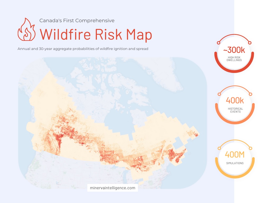
Based on dataset, climate85 analyzed all properties in Canada and estimated that roughly 300,000 buildings are exposed to a high wildfire risk, with a 14% or greater probability of being affected over a 30-year period. Furthermore, over one million properties carry a minor risk (i.e., greater than 1%) of being impacted by wildfires during the typical mortgage term, potentially putting homeowners at risk of losing their property.
Climate85 uses a state-of-art, peer-reviewed and globally recognized methodology to ensure the best possible data quality of this datasets. This approach incorporates a variety of data sources, such as historical weather patterns, national fire-fuel maps, digital elevation models, and prevailing wind patterns, to pinpoint areas where fires may occur and spread. By analyzing the locations of more than 400,000 historical fires and running over 400 million simulations, climate85 has created a probability map of wildfire risk scores that spans across Canada.